


- Beth Schlemper
- Associate Professor
- Advancing Geospatial Thinking and Technologies in Grades 9-12: Citizen Mapping, Community Engagement, and Career Preparation in STEM
- http://www.utoledo.edu/llss/geography/research/SchlemperResearch.html
- University of Toledo
- Kevin Czajkowski
- https://www.utoledo.edu/llss/geography/facultystaff/deptfaculty/czajkowski.html
- Professor
- Advancing Geospatial Thinking and Technologies in Grades 9-12: Citizen Mapping, Community Engagement, and Career Preparation in STEM
- http://www.utoledo.edu/llss/geography/research/SchlemperResearch.html
- University of Toledo
- Sujata Shetty
- Associate Professor
- Advancing Geospatial Thinking and Technologies in Grades 9-12: Citizen Mapping, Community Engagement, and Career Preparation in STEM
- http://www.utoledo.edu/llss/geography/research/SchlemperResearch.html
- University of Toledo
- Victoria Stewart
- Advancing Geospatial Thinking and Technologies in Grades 9-12: Citizen Mapping, Community Engagement, and Career Preparation in STEM
- http://www.utoledo.edu/llss/geography/research/SchlemperResearch.html
- University of Toledo


Public Discussion
Continue the discussion of this presentation on the Multiplex. Go to Multiplex
Beth Schlemper
Associate Professor
First of all, I would like to thank John Eidemiller, Executive Media Producer, Department of Communication at the University of Toledo, for assisting us in producing this awesome video! He will be capturing footage of students in action during this summer’s workshop, June 6-17, 2016.
Victoria Stewart
Associate Professor
The video does a nice job highlighting our first year of the project, with emphasis on the two week workshop that was conducted in June 2015. We are currently preparing for year two beginning on June 6 and look forward to working with another great group of students from Jesup W. Scott High School!
Vivian Guilfoy
Senior Advisor
Students are looking at critical community infrastructure issues. What would you say are the most significant things they have learned about their community? about themselves? about the use of data to tell a story or make a point? What new analytical and geospatial tools would you say are the ones that students use most in their work? Were there any big surprises in the data that students discovered and shared with community leaders? Does your research capture information on how the program is making an impact on participants, teacher and other advisors, community service providers? How has Year One challenges and successes shaped Year Two?
Beth Schlemper
Associate Professor
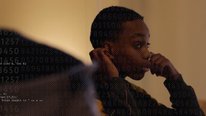
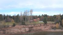
I think the students, who participated last summer, learned that there are a lot of people and organizations working together to address community needs that they didn’t know about already. We tried to introduce students to a number of different people that use spatial thinking (and data) in their careers in the community from a variety of different angles, including government, nonprofits, education, and private industry. Because most students don’t realize that careers in geography and the geospatial industry are projected to grow by 35% over the next 10-20 years (or what geography is to begin with), this was also news to them. As a result, we integrated careers information throughout the workshop also. For your question about using data and geospatial tools: While students walk to and from school as well as spend time in the community in other ways, their perceptions of their neighborhoods are on a personal level. By collecting data in the neighborhood and examining secondary data, students were able to visualize issues in more depth. They inserted the data they collected into maps using ArcGIS online, and seeing the maps was revealing to them! At times they were surprised by the results, such as one group that hypothesized that the condition of houses in the neighborhood related to crime rates. Instead, they concluded that unfortunately crime was widespread regardless of the condition of houses. They decided that houses that were in severe decline did, however, impact property values and created potentially dangerous conditions for people in the community. Students shared their findings three times: once on the last day of the formal workshop and then two more times through invited presentations (downtown at the Mayor’s office and later for a nonprofit neighborhood organization). We are in the second year of the project, and we do have a teacher advisory committee that is working with us as we begin to create curriculum based on the experiences of these workshops (we have a second workshop this summer). Both specific topics (i.e. housing, community needs, green space, etc.) and related curriculum (integrating geospatial technology as geoprogessions or learning progressions style and career paths) are being explored and refined during the workshops. Ultimately, our plan is to create curriculum materials for both physical science and social studies that can be adapted by teachers regardless of the setting (urban, suburban, rural). We started to pilot a few curriculum modules with our teacher advisors in year 2, but curriculum development and piloting will dominate year 3 of the project.
Emily Peterson
Interesting project. How do you select students to participate and how did you decide on 2 weeks as the length of the workshop? Do you think that there is the potential to integrate this into the high school curricula?
Beth Schlemper
Associate Professor
Emily, I believe Sujata Shetty replied to your questions below.
Joel Studebaker
It’s really exciting to see a a project that uses geospatial technology to involve students more deeply in their own community. It would be great to hear if any of the ideas proposed by students have been taken up by community leaders!
Beth Schlemper
Associate Professor
Joel, it’s been a really rewarding project so far. The students appreciate the participation of community leaders throughout the workshop, and even afterwards. We integrated speakers from the community, who could talk to the students about their careers and how they use spatial thinking (and data) in their work. The last day of the workshop was an opportunity for the student groups to present their projects to the guest speakers, the Mayor, school teachers and administrators, their families, and other key community stakeholders. The exciting thing was that Mayor’s office asked the students to present their projects to the Department of Neighborhoods after the formal workshop, and they were also asked to present for a third time to a nonprofit neighborhood organization. While one of the student groups wanted a youth center (which requires money the city doesn’t have right now), another group was concerned about the condition of some of the houses in the neighborhood. Some of the houses near the school have been torn down and the rubble removed. I don’t know if it was because of the students’ presentation, or if the city is slowly getting around to addressing the issue. Thanks for your comment!
May Jadallah
This is truly exciting. Do you have any plans to follow the students up in a year or two to examine the long term impact of this opportunity on students’ cognitive processes, vocational interests, and psychological involvement?
Beth Schlemper
Associate Professor
Great question, May. While we would really like to do this, this group of students is highly mobile, most likely due to socio-economic situations, and it is difficult to track them once they move out of town. However, as we start to create curriculum modules that can be used by our teacher advisors (and later perhaps in another project in more schools with even more teachers), examining long term impact will certainly be an important goal.
Sujata Shetty
Associate Professor
Emily, thank you for your questions. We worked closely with the school and with the United Way “Schools-as-Hubs” director at the school to recruit students. As a new project, recruitment was challenging the first year, but this year we were able to visit the school ahead of time to generate interest and will have two teachers from the school join us during the workshop. They are helping with recruitment as well. Plus, we now have alums from year one who are helping spread the word!
The workshop was initially designed to be one of many offerings through Camp Fundamentals, a summer camp program run by Schools as Hubs, a United Way sponsored program in partnership with the Toledo Public Schools and other stakeholders. Camp Fundamentals was designed as a two week program and shaped the length of our workshop.
There is certainly potential to integrate this into high school curricula. With help from a member of our Teacher Advisory Committee, we just piloted a module at a local high school. Our plan is to develop and pilot more such modules, tied to science and social studies standards, to make it easier for teachers to integrated STEM concepts in their classrooms.
Lisa Samford
Executive Director
How many students participated in the project? Are you making the modules available for others to consider integrating into curriculum? I’m impressed that it is largely student-driven.
Beth Schlemper
Associate Professor
Great questions, Lisa! The two summer workshops have several purposes, such as: 1) to generate ideas from students for topics to include in curriculum development; 2) to experiment with integrating technology and inquiry through a learning progressions approach; and 3) to discover what works best in terms of connections to career paths. Last year was a pilot of the workshop and we had around 10 students participate (see Sujata’s comments above about recruitment challenges). This year we are expanding the workshop and also including two of the teachers at the high school during the workshop (and they are helping us with recruitment). The workshops are really designed, however, to be a testing of our ideas, so that we can generate curriculum based on these experiences in year 3 of the project. We are tested some preliminary modules with our teacher advisory committee in their classrooms, and plan to do more of this in year 3. Ultimately, the curriculum will be available to integration into both science and social studies classrooms. We would like for it to be setup in such a way that teachers, who are already pressed for time during the day, can pull out pieces of each module (such as the careers component or a specific activity) if they don’t have the time to integrate an entire module.
Vivian Guilfoy
Senior Advisor
Helping students to “see” firsthand the connection between technology, community, and careers seems to be one of the most exciting aspects of this program. Students tend to see their futures as “either/or”—across technology and community building. As improving our country’s infrastructure becomes increasingly important, this connection needs to become more and more explicit in the minds of the students. How are you bringing this message home to them, in addition to the speakers from the community?
Beth Schlemper
Associate Professor
Good question, Vivian. Thanks for the follow-up. In addition to guest speakers, each day we have integrated a variety of activities or discussions related to links to careers. There are, for example, several good sources of short videos and careers profiles to illustrate to the students how geography and geospatial technology addresses 21st century issues and the kinds of careers that they could pursue. The American Association of Geographers has several excellent sources: http://jobs.aag.org/home/index.cfm?site_id=15004. Also, there is a good video series on-line called the Geospatial Revolution: http://geospatialrevolution.psu.edu/. Finally, we had some success having an informal discussion with the students about their current career plans, while each of the co-PIs took turns talking about our own career paths and how we ended up where we are today.
Vivian Guilfoy
Senior Advisor
Thanks for the additional resources!
Tamara Ball
Asst. Project Scientist
I agree with Vivian’s comment above – this program seems valuable creating career pathways from live connections established through meaningful co-productive work with professionals.
As far as the specific STEM learning outcomes It would be helpful to know more about the activities or the data that students collected and analyzed that “increased geo-spatial thinking” . Were some projects more conducive to this than others? What could students do by the end of the experience that they could not do prior to it?
Kevin Czajkowski
Professor
We tried to use a progression of geospatial activities to help prepare the students to develop their projects. We started with reading a map of their region, used a remote sensing mapping game AmericaView created, had them stump each other with satellite images of a location they chose, had them use ArcGIS online analyzing a data set about fish, etc. They did a GPS treasure hunt on the first day and also found a geocaching site near the school later in the week. The students also watched a Ted talk about Gettysburg and Robert E. Lee’s viewshed. I think the projects were similar in use of geospatial technologies.
Vivian Guilfoy
Senior Advisor
With all the buzz about “big data,” this program gets students enrolled in fundamentals that can help them not only analyze data, but perhaps also contribute to it. Have you had instances where the participants are contributing to ongoing data collection sources in their community? Have they come up with data that “should” be collected but can’t now be found?
Beth Schlemper
Associate Professor
That’s an interesting question, Vivian. One of the student groups was interested in the relationship between crime and housing. They ended up created a rating scale for the condition of houses in the neighborhood from excellent to hazardous (A to F). We (the co-PIs) were aware that the County Land Bank had already done a similar ranking of the housing stock in the City recently. After the students collected their data, we shared this survey and related maps to the students so they could see how they compared and if there had been any changes since the Land Bank had conducted their survey. We also discussed the applications of this kind of data. On the one hand, it is helpful for a city to examine the “health” of the housing stock. On the other hand, if your house or someone’s you know is rated a D or F, that may make you feel bad or inadequate. For your second question, the students were really interested in the conditions of the infrastructure in the neighborhood (sidewalks and potholes in the roads). They did collect GPS coordinates and take pictures of particularly bad areas. They then had excellent questions about whose responsibility it was to take care of the sidewalks and roads. They learned (from one of the guest speakers) that often it is the responsibility of the homeowner to repair broken or missing sidewalks, unless a tree on city property is causing the problem. They also heard from several people that as citizens it is their responsibility to report problems to the city because otherwise the city might not know.
Michael Middleton
This looks like a terrific project. Congratulations to you and to the youth for this wonderful work connecting them with their community through science exploration. The video mentions that the participating youth are able to identify the project or topic of exploration. How do you guide the youth participants in choosing a topic? Does the entire group decide together? Do they work in smaller teams based on interests? In our project with middle schoolers, we have them choose a local community practice that they will examine for its sustainability. For our teachers and mentors, identifying a manageable topic and getting consensus within the group on their focus topic can be a challenge!
Beth Schlemper
Associate Professor
Thank you, Michael! Selecting the topics was a multi-stage process. We have a teacher advisory committee made up of three science and three social studies teachers as well as a project evaluator. In the early stages of the project, we met several times to brainstorm topics we thought that students might suggest related to both science and social studies. We created a one-page worksheet that allowed students to rank those topics, AND to add some of their own. The teacher advisors polled some of their classes prior to the official workshop. We also had a few teachers at the high school, where the workshop was going to be held, give the same worksheet to a few of their classes. Based on the feedback from those two efforts, we narrowed the choices to about a half a dozen. On the first day of the workshop, the student participants ranked those topics and we created groups based on their interests. We found that the students ended up exploring more than one topic, however, such as crime and housing together rather than as separate topics. Through the discovery process (collecting data and examining secondary data), it became evident that they were related. We’ll see how it works this summer when we start the second workshop in early June!
Further posting is closed as the showcase has ended.